AEC Technology Updates Straight to Your Inbox
Thank you! Your submission has been received!
Oops! Something went wrong while submitting the form.
By subscribing, you agree to our Privacy Policy and consent to receive updates from our company.


.webp)
.svg)


December 30, 2025

2:11 pm
3
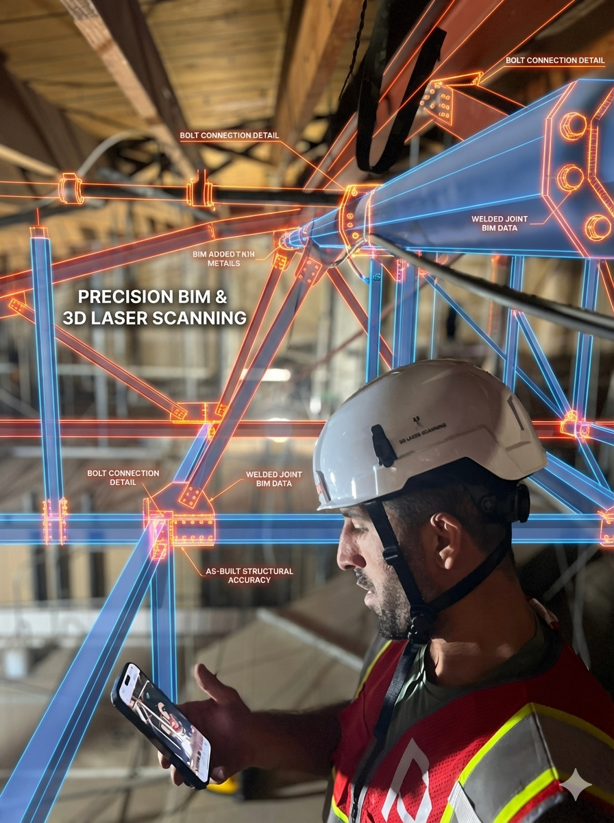
Construction and renovation projects frequently encounter budget-busting delays caused by inaccurate site data, but utilizing 3D laser scanning offers a powerful solution by capturing existing conditions with millimeter-level precision. For architects, engineers, and construction professionals, understanding how to implement this technology is no longer optional it is critical for eliminating the risks associated with manual measurement errors and outdated documentation.
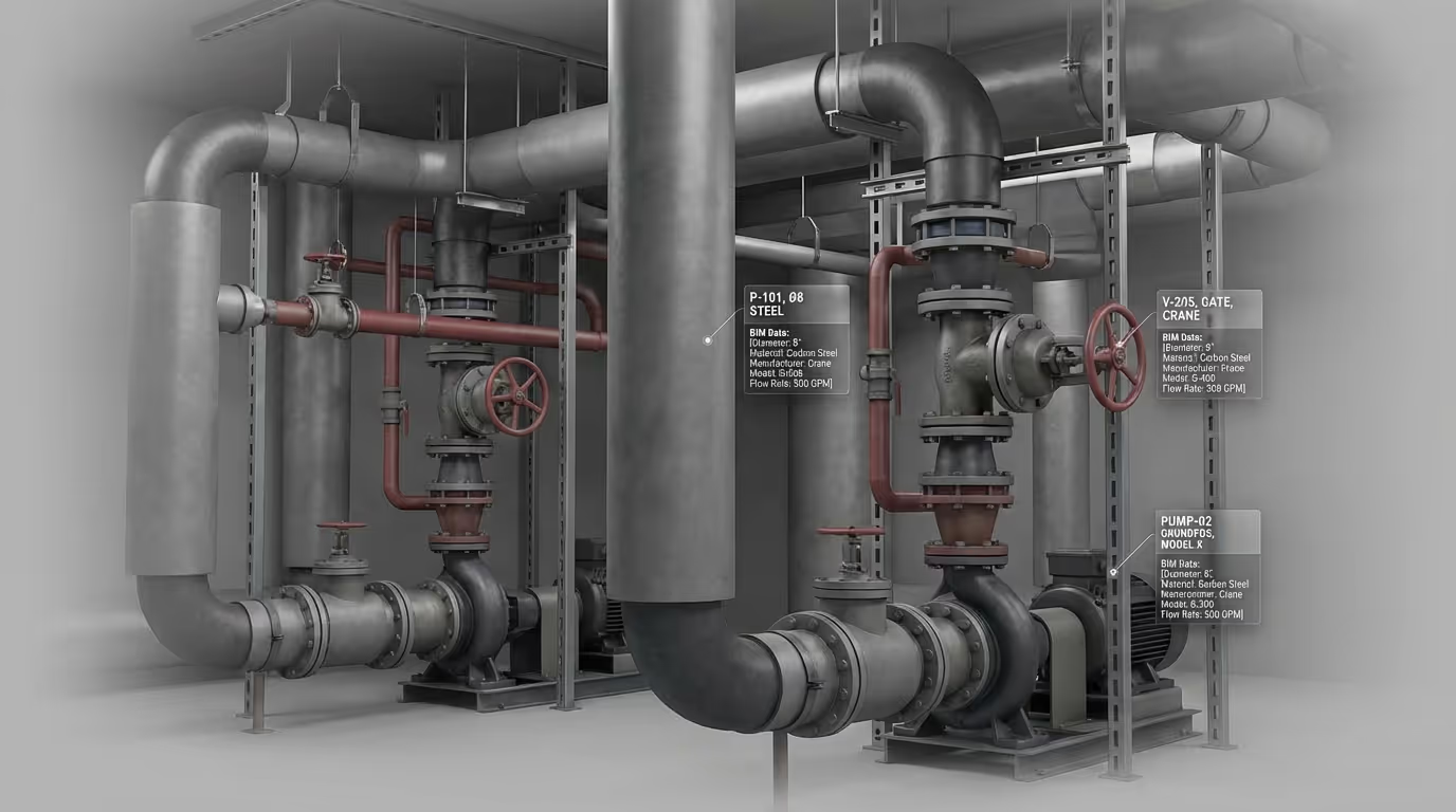
The process starts by deploying LiDAR technology to capture millions of data points per second, generating a comprehensive "point cloud" that serves as a dimensionally accurate digital twin of the physical space. Unlike traditional surveying, which can be slow and selective, this method rapidly documents every visible surface, from complex MEP systems to structural geometry, without disrupting ongoing operations. To successfully execute a scan-to-BIM workflow, teams must first define the project scope and the necessary Level of Development (LOD), ranging from basic spatial coordination (LOD 200) to fabrication-ready detail (LOD 400).
Once the data is captured, it is processed and registered to create a unified 3D model compatible with design platforms like Autodesk Revit or Navisworks. This shift from analog to digital verification is transformative. Industry data suggests that poor data and miscommunication contribute to nearly half of all construction rework, costing the global industry billions annually. By adopting 3D scanning, you can identify clashes between new designs and existing conditions before breaking ground, reducing change orders by up to 50% and accelerating project schedules. Whether for historic preservation or industrial retrofitting, mastering this workflow ensures you build from reality, not assumptions.
By subscribing, you agree to our Privacy Policy and consent to receive updates from our company.