
At Plansrow, our 3D laser scanning services are not just about using cutting-edge technology; it's about how we use that technology to meet your specific needs. We prioritize immediate action and meticulous coordination with your project team architects, civil engineers, and MEP professionals to deliver precisely what you need, when you need it.
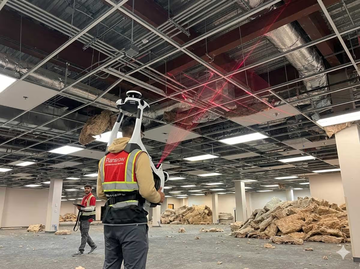
Most firms redraw what they see. We don’t. At Plansrow, every As-Built drawing is field-verified, accuracy-checked, and crafted to eliminate surprises so your renovation, permit, or design workflow stays on track from day one.
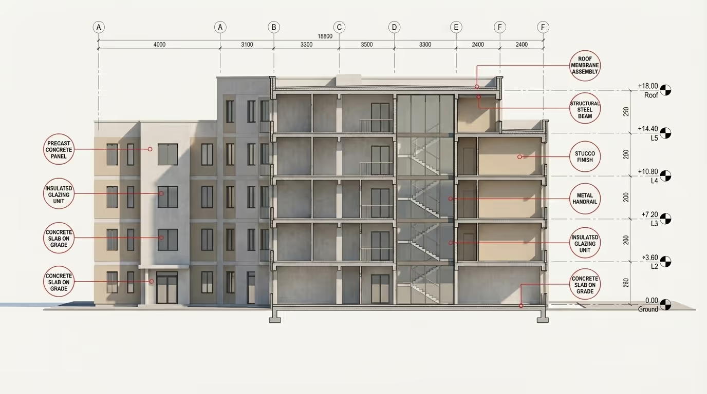
Most companies treat BIM as a “3D model.” We don’t.
At Plansrow, BIM means data-rich, code-aligned, construction-ready intelligence built into every element so your project runs smoothly from design to handover & beyond.
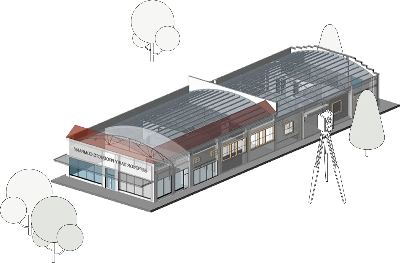
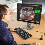
Capture real building conditions with advanced 3D laser scanning. We turn point-cloud data into precise 2D drawings and 3D BIM models so you can plan, coordinate, and execute MEP work with confidence.
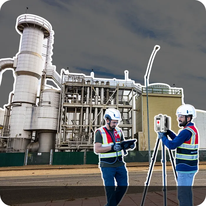
Using RTK drones, GPS surveying systems, and remote field team deployment capabilities. From land mapping to infrastructure documentation, we collect the data you need to plan, design, and build with confidence.

Plansrow’s drafting and BIM team helps architects, engineers, and structural firms deliver projects on time with accuracy, consistency, and zero overhead.
Easy onboarding. Fast turnaround. Your standards, our team.









Plansrow has built its reputation in the San Francisco Bay Area and across California on one foundational commitment: delivering millimeter-accurate spatial data that AEC professionals can build on without second-guessing. When an architect, structural engineer, or contractor commissions a 3D laser scan, they are making a downstream decision that affects every design decision, every MEP coordination, and every renovation scope that follows. Plansrow uses Leica scanners and Matterport capture technology to generate point clouds of exceptional density and accuracy, processed through Autodesk software into the deliverable format your team requires — whether that is a point cloud, a Revit model, as-built CAD drawings, or a full BIM model. With more than 15 years of industry experience, over 3 million square feet documented, and a team of 30+ dedicated professionals, Plansrow is the laser scanning partner that San Francisco, San Diego, and Fresno AEC firms trust to move their projects forward without delays, rework, or budget surprises.
Plansrow serves the full spectrum of AEC professionals across California and nationwide, providing 3D laser scanning that integrates seamlessly into every project workflow. For architects, our point clouds and Revit models provide the verified existing-conditions data needed to design additions, renovations, and adaptive reuse projects with confidence. For structural and MEP engineers, our millimeter-accurate as-built documentation eliminates the costly guesswork that slows coordination and generates change orders. For developers and general contractors, our scan-to-BIM services and as-built drawings reduce field verification time and catch scope-altering discrepancies before they become expensive problems on-site. Trusted by clients including the US Navy, Lennar, KB Home, 4-Creeks, and Omninet, Plansrow's track record spans commercial, institutional, residential, industrial, and infrastructure projects across San Francisco, San Diego, Fresno, and beyond.

At Plansrow, we understand that nothing derails a project faster than inaccurate data, outdated workflows, and the costly delays they create. If you’re tired of traditional surveying methods slowing you down and driving budgets up, you’re in the right place.
Our full range of professional precision engineering services are tailored to tackle your toughest challenges head-on. With cutting-edge 3D laser scanning, GIS mapping, and BIM modeling in our arsenal, we don't just deliver accurate documentation we streamline your processes, boost collaboration, and make sure your projects hit the finish line on time and on budget.
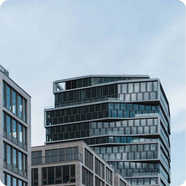


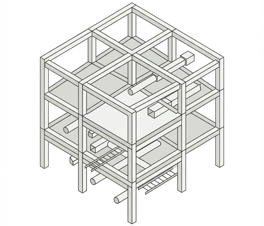
Scan to BIM is the process of converting 3D laser scan point cloud data into intelligent, data-rich Building Information Models — and it is one of the highest-value services Plansrow delivers to AEC firms across San Francisco, San Diego, and the broader California market. Unlike a simple CAD as-built drawing, a BIM model created from a point cloud contains parametric components, MEP system data, structural element properties, and space geometry that supports project coordination, facility management, and long-term building lifecycle decisions. Plansrow's Revit modeling team builds BIM models to the Level of Development (LOD) specified by your project requirements, whether LOD 200 for schematic design or LOD 400 for construction-ready coordination. Our process is precise, fast, and designed to integrate directly with your firm's existing Revit or AutoCAD workflow.
Plansrow's as-built documentation services provide architects, engineers, and facility managers with verified, field-accurate records of existing building conditions — the kind of documentation that prevents costly surprises during renovation, permitting, and compliance work. Every Plansrow as-built drawing is produced from real field data captured by our scanning team, not estimated from outdated construction documents or rough field measurements. We deliver floor plans, elevations, sections, reflected ceiling plans, MEP routing diagrams, and structural details in CAD or PDF format to match your project's documentation standards. Our as-built services are trusted by firms across San Francisco, San Diego, Fresno, Los Angeles, and Sacramento, and our track record of on-time delivery is one of the core reasons clients like LandDesign and 4-Creeks return to Plansrow project after project.




.webp)
.png)
Engineering firms across California rely on Plansrow's civil engineering production support to scale their drafting and documentation capacity without the overhead of hiring full-time production staff. Whether your team needs additional CAD drafters to meet a deadline, BIM coordinators to manage a complex coordination model, or complete production support for a large infrastructure project, Plansrow's 30+ member team is ready to deploy immediately. Our production team is experienced in AutoCAD Civil 3D, Revit, and standard AEC documentation workflows, ensuring your deliverables meet the quality and formatting standards your clients expect. Same-day onboarding and fast turnaround make Plansrow the production partner of choice for civil engineering firms in San Francisco, San Diego, and Fresno who cannot afford delays.
Plansrow's GIS mapping services provide developers, infrastructure engineers, and public-sector clients with fast, accurate, and field-ready geospatial data for land mapping, infrastructure documentation, and site analysis. Using RTK drones, GPS surveying systems, and remote field team deployment capabilities, our GIS team captures the spatial data your project requires with the speed and precision that California's fast-moving development environment demands. From land mapping in Fresno to infrastructure documentation in San Francisco and San Diego, Plansrow delivers GIS deliverables that integrate directly into your ArcGIS, AutoCAD, or Civil 3D workflows. Request an instant GIS mapping quote today.

Design Builds & Remodels

Education

Retail & Restaurant Construction

Water & Sewer

Engineering & Surveying

Civil, Road & Bridge

Power Transmission & Distribution

Telecom

Oil & Gas

Power Generation

Facilities

Electric Vehicle Charging

One Call

Environmental









Find answers to commonly asked questions about our civil engineering services.

As-built documentation provides accurate data and detailed records of a structure's current condition. This information is crucial for renovations, compliance, and effective engineering solutions, ensuring that any modifications, AI applications, or automated processes rely on precise data.
3D laser scanning uses LiDAR technology to emit laser pulses that bounce off building and site surfaces, measuring the time of flight for each pulse to calculate precise distance values. The result is a point cloud — a dense digital representation of a space with millions of individual data points, each with an exact X, Y, Z coordinate. Plansrow's field teams use Leica professional-grade scanners and Matterport systems to capture point clouds at millimeter accuracy across any size space, from a single room to an entire campus. The point cloud is then processed into as-built drawings, BIM models, or GIS deliverables depending on your project requirements
We offer a comprehensive suite of services designed to support precise data capture, intelligent documentation, and production assistance for construction, engineering, and automation projects. Our core services include:
3D Laser Scanning: We utilize advanced laser scanning technology to create highly accurate digital representations (point clouds) of existing structures, capturing every detail with precision.
As-Built Documentation: Our as-built documentation services provide an exact record of a building or facility’s current state, ensuring accurate data for renovations, compliance, and maintenance planning.
BIM Modeling: We deliver Building Information Modeling (BIM) services, creating detailed, intelligent 3D models compatible with industry-standard software like Revit and ArchiCAD, which supports seamless project collaboration.
GIS Mapping: For large-scaOur GIS mapping services offer geographic data collection and mapping for large-scale projects, which isle projects, our GIS mapping services offer geographic data collection and mapping, essential for urban planning, land development, and infrastructure projects.
Complete Drafting & Production Support: We provide full drafting and production support for architectural and civil engineering firms, helping to streamline design workflows, increase productivity, and deliver high-quality project documentation.
Virtual Tours & Panoramic Imagery: We offer immersive 360-degree virtual tours and high-resolution imagery that allow stakeholders to remotely explore and understand spaces without being physically present on-site.
AI & Automation Data Integration: Our data is customized to support AI and automation initiatives, enabling predictive maintenance, smart building management, and engineering automation.
Scan to BIM is the workflow of converting a 3D laser scan point cloud into an intelligent Building Information Model — typically in Autodesk Revit. The resulting model is not just a visual representation; it contains parametric data for structural elements, MEP systems, spatial geometry, and building components that support design coordination, engineering analysis, and facility management. Scan to BIM services are most commonly needed by architects designing renovations, MEP engineers coordinating system modifications in existing buildings, developers performing due diligence on acquisition targets, and facility managers building a digital twin for long-term building operations. Plansrow delivers scans to BIM models to any LOD specification for clients across San Francisco, San Diego, Fresno, and nationwide.
Our team brings over 15 years of industry experience, delivering precision-driven data and support for a wide range of projects in construction, architecture, and engineering. With expertise across 3D laser scanning, BIM modeling, GIS mapping, and production support, we have successfully partnered with architects, civil engineers, and developers to meet complex project needs with accuracy and efficiency. Our extensive experience ensures that each project receives the highest standard of service, backed by years of hands-on expertise and industry knowledge.
Plansrow's 3D laser scanning services achieve millimeter-level accuracy using Leica professional scanning equipment — the highest-precision hardware available in the commercial scanning market. Our field teams follow a rigorous scan registration process that verifies positional accuracy across the entire point cloud, ensuring that every corner, wall, pipe, and structural element is captured with the spatial precision your downstream workflows require. With over 3 million square feet of documented space and 15+ years of field experience, our team has developed the practical expertise to deliver consistent accuracy across complex building geometries, multi-story structures, industrial facilities, and large-scale infrastructure sites.
Our services cater to a diverse range of professionals and industries, including:
Architects and Engineers: Obtain precise as-built data, BIM models, and GIS mapping to enhance project planning, design accuracy, and documentation while minimizing on-site guesswork.
Civil Engineering Firms: Access complete drafting, production support, and reliable site data to improve project efficiency and resource management.
Developers and Contractors: Use our 3D laser scanning and as-built documentation to reduce errors, avoid costly rework, and stay on schedule.
Facility Managers and Building Owners: Take advantage of accurate documentation and virtual tours for better maintenance planning, compliance, and facility optimization.
Construction Industry: Depend on our utility locating, concrete scanning, and mapping services to enhance project safety and accuracy during construction.
Infrastructure Development: Gain insights into existing site conditions through 3D laser scanning, mapping, and drone imagery, ensuring effective planning and execution for infrastructure projects.
Smart Engineering and AI Projects: Our high-quality data and documentation support automation, predictive maintenance, and smart building management initiatives.
Project timelines for 3D laser scanning depend on the size and complexity of the space, access requirements, and the deliverable format requested. A standard commercial floor requiring as-built drawings can typically be scanned and delivered within one to three days. Larger multi-story structures, campus-scale facilities, or projects requiring full BIM modeling may take one to two weeks from field capture through final model delivery. Plansrow is known for fast mobilization — our field teams deploy promptly to San Francisco, San Diego, Fresno, and all California metro areas — and our production team turns around deliverables on a schedule that keeps your project on track.
Getting started with us is straightforward. Here’s what you need to do:
1. Contact Us: Reach out through phone, email, or our website contact form to discuss your project needs. We’ll schedule a consultation to understand your requirements.
2. Initial Consultation: During this conversation, we’ll gather details about your project’s scope, timeline, and specific goals. This helps us tailor our services to meet your expectations.
3. Receive a Custom Proposal: Based on the consultation, we’ll provide a customized proposal that outlines the recommended services, deliverables, timeline, and pricing.
4. Project Kick-Off: Once you approve the proposal, we’ll initiate the project with a clear plan and schedule, keeping you informed at every step.
Plansrow delivers a full range of outputs from our 3D laser scanning services. Depending on your project requirements, deliverables include: registered point cloud files (RCP/RCS for Revit, E57, or LAS formats), as-built CAD drawings (floor plans, elevations, sections, details, RCPs, isometric MEP diagrams), Revit BIM models at specified LOD, Matterport virtual tours and panoramic imagery, GIS data layers, and civil engineering production documentation. Our team works with you during scoping to define the exact deliverable set your project requires.
Yes. While Plansrow maintains strategic hubs in San Francisco, San Diego, and Fresno, California, we serve AEC clients nationwide — with active operations in Austin, Baltimore, and Seattle, and field team deployment capabilities across the United States. Our clients include national firms, government agencies such as the US Navy, and national homebuilders including Lennar and KB Home who require consistent, high-quality 3D laser scanning and scan-to-BIM services across multiple project locations. Contact us today to discuss your project regardless of location.
Plansrow offers an instant online quote tool that provides fast, customized pricing for your 3D laser scanning, BIM modeling, as-built documentation, or civil engineering production project. You can also reach our San Francisco team at (800) 201-0930 or our Fresno office at (877) 812-2117. Our team responds promptly to all quote requests and can typically begin project scoping within one business day of your initial inquiry.
By subscribing, you agree to our Privacy Policy and consent to receive updates from our company.


.webp)
.svg)



.svg)
