AEC Technology Updates Straight to Your Inbox
Thank you! Your submission has been received!
Oops! Something went wrong while submitting the form.
By subscribing, you agree to our Privacy Policy and consent to receive updates from our company.


.webp)
.svg)


January 9, 2025

11:47 am
.png)
Advancements in technology have revolutionized the way surveying and mapping are done, and one tool leading this transformation is 3D model laser scanning. This cutting-edge technique is not only changing how professionals work but also unlocking new opportunities across various fields. With its ability to capture detailed and precise measurements, 3D laser scanning has become indispensable for projects that demand accuracy and efficiency.
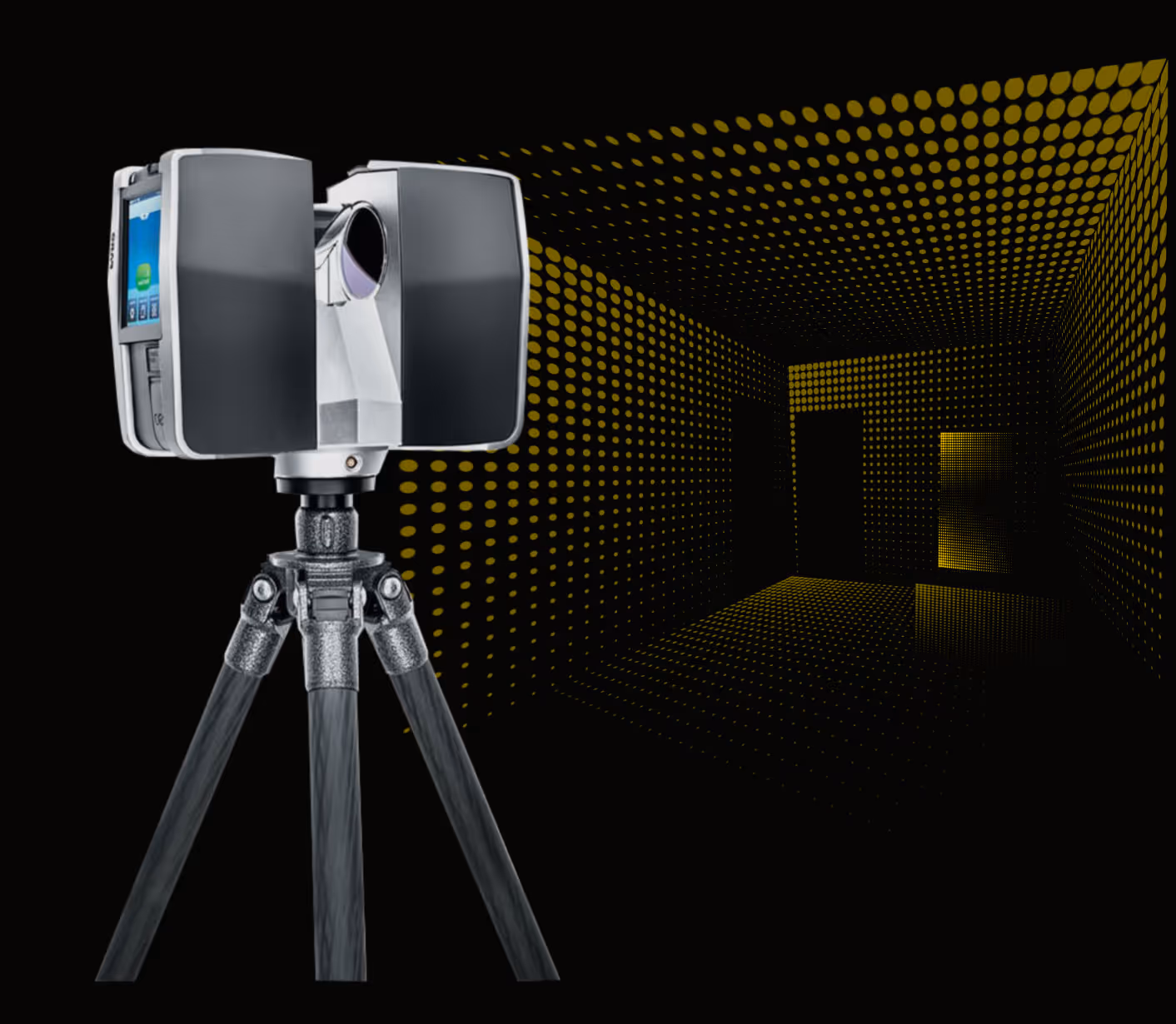
3D model laser scanning uses laser technology to gather precise spatial data about objects, buildings, and landscapes. The scanner emits laser beams that reflect off surfaces, capturing details about distance, shape, and dimensions. These data points are compiled into a "point cloud," which can be transformed into a highly detailed 3D model. Unlike traditional methods, this process is faster, non-invasive, and capable of capturing intricate details that might otherwise be missed.
When precision is paramount, laser scanning delivers unmatched results. It eliminates errors and ensures professionals can rely on accurate data for their projects.
Conventional surveying methods often take considerable time and effort. With us, large areas can be surveyed quickly, allowing professionals to focus more on data analysis and less on data collection.
This technology is incredibly versatile, benefiting fields like urban planning, architecture, environmental studies, and historical preservation. It enables the creation of accurate models for any setting, from cityscapes to remote terrains.
Surveying in hazardous or difficult-to-reach areas can be risky. The 3D model allows data collection from safe distances, reducing the need for physical access to dangerous sites.
Surveying and mapping professionals can take advantage of this technology in many ways. Here are some key applications:
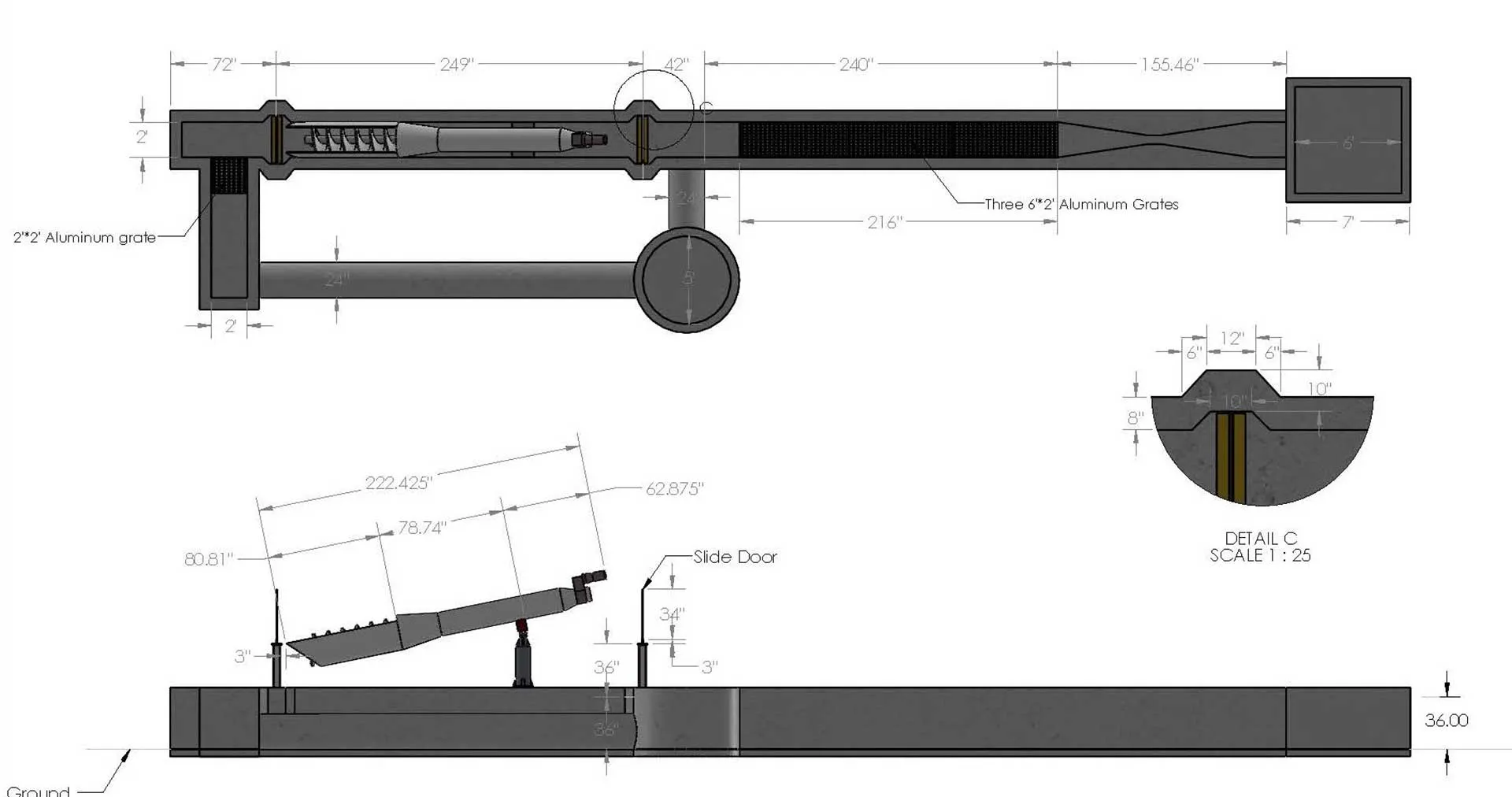
For architects and land developers, precision is crucial for successful project planning. Laser scanning provides comprehensive terrain data, identifying potential challenges early on.
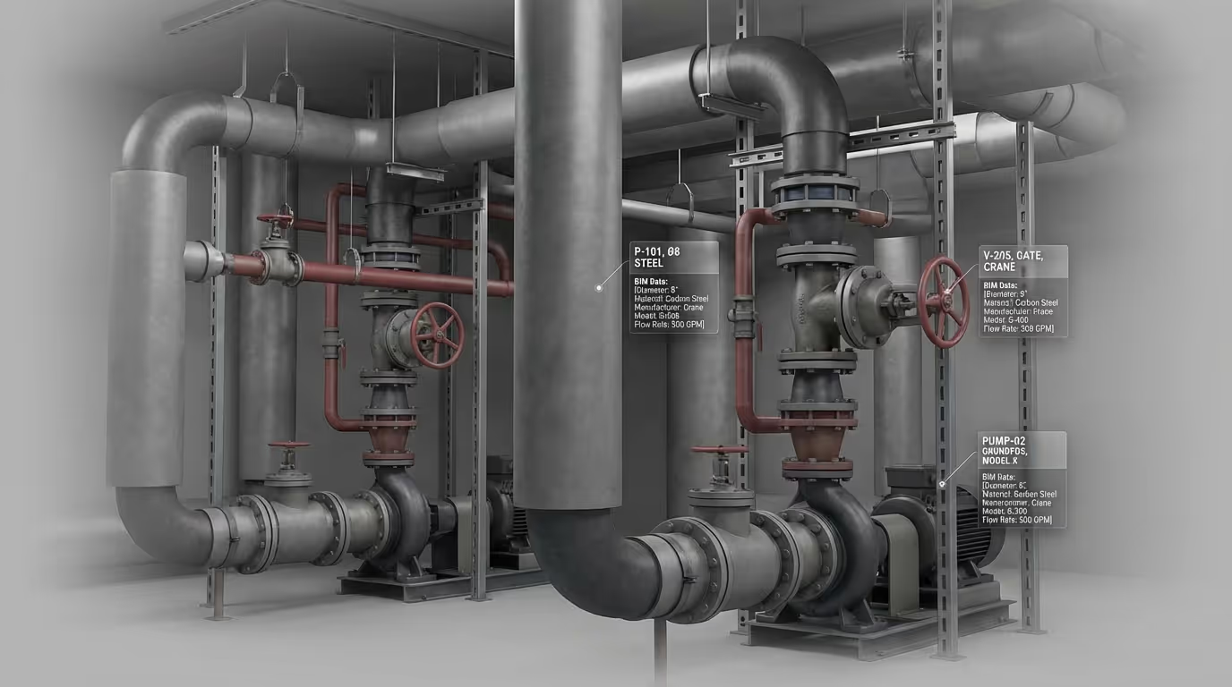
With the help of data mapping services, professionals can create detailed maps showcasing topography, infrastructure, or underground utilities. This technology ensures clients get a complete and accurate understanding of their project area.
Monitoring the condition of bridges, tunnels, and other structures is essential for safety. 3D model laser scanning helps detect cracks, deformations, or other issues with exceptional accuracy, enabling timely repairs and maintenance.
For historical preservation projects, this technology is invaluable. It creates precise digital replicas of monuments and sites, aiding restoration efforts while preserving authenticity.
As industries embrace digital advancements, the demand for technologies like 3D laser scanning will continue to rise. Its ability to deliver accurate, versatile, and reliable data makes it essential for modern surveying and mapping practices. Additionally, as the technology becomes more accessible, professionals will discover even more innovative ways to utilize it.
If you’re considering integrating laser scanning into your workflow, here are some tips to get started:
1. Choose the Right Equipment: Invest in high-quality scanners that meet the specific needs of your projects.
2. Focus on Training: Ensure you and your team are well-versed in operating the equipment and processing the data.
3. Collaborate with Experts: Partner with specialists in data mapping services to maximize the value of your scanned data.
4. Stay Informed: Keep up with advancements in 3D scanning technology to maintain a competitive edge.
The rise of 3D model laser scanning has revolutionized the way surveying and mapping professionals work. Its ability to provide accurate, efficient, and versatile solutions has made it a vital tool in the industry. As more professionals adopt this technology, its applications will continue to grow, pushing the boundaries of what’s possible. For those aiming to stay ahead, integrating 3D laser scanning into your workflow is a smart move toward embracing a more innovative and precise future.
By subscribing, you agree to our Privacy Policy and consent to receive updates from our company.