


Use accurate drawings for layout, demolition plans, takeoffs, and coordination.

Get a digital record for future renovations, tenant improvements, or expansions.
Dependable backgrounds that show real beams, utilities, mechanical rooms, slopes, and constraints.
.webp)
Start design with a verified foundation, reduce surprises, and eliminate rework.


We tailor deliverables to your project type, software, and level of detail.
.svg)
Reflected Ceiling Plans (RCP) – ceiling heights, soffits, lighting, diffusers
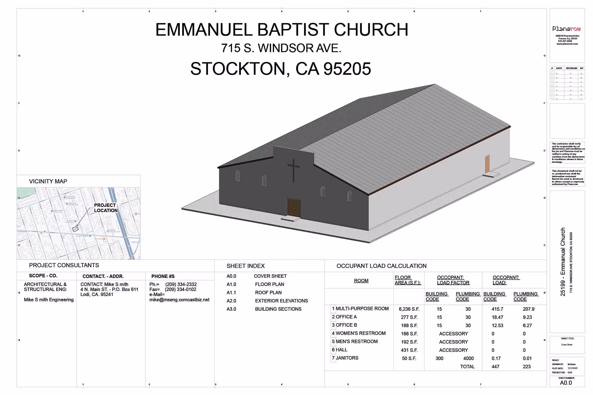
Building Sections & Profiles – vertical relationships, roof structure, floor elevations
Roof Plans – slopes, drains, mechanical equipment
Site Plans – landscape, curbs, utilities, sidewalks (if requested)
Exterior Elevations – materials, openings, heights, architectural elements
Floor Plans – walls, doors, windows, partitions, structural elements
.svg)
MEP/VAV/Fan Coil layouts
Fire Protection as-builts
Structural framing plans
Equipment locations & verification
Finish schedules and room data
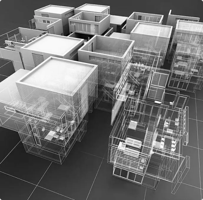
Scan to BIM (Revit/Archicad models)


We tailor deliverables to your project type, software, and level of detail.

Get a digital record for future renovations, tenant improvements, or expansions.
.webp)
Clean linework optimized for architects and engineers
.webp)
Fast turnaround (you already have a reputation for fast delivery)
.webp)
Single vendor for 3D scanning + as-builts + BIM.

Design Builds & Remodels

Education

Retail & Restaurant Construction

Water & Sewer

Engineering & Surveying

Civil, Road & Bridge

Power Transmission & Distribution

Telecom

Oil & Gas

Power Generation

Facilities

Electric Vehicle Charging

One Call

Environmental


.svg)
Find answers to commonly asked questions about our 3D laser scanning services.
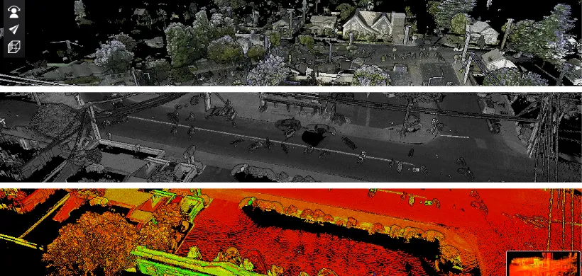
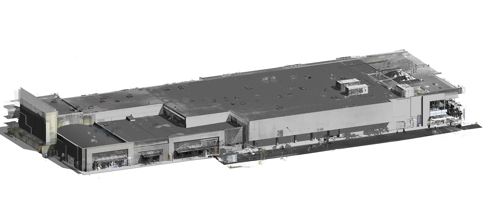
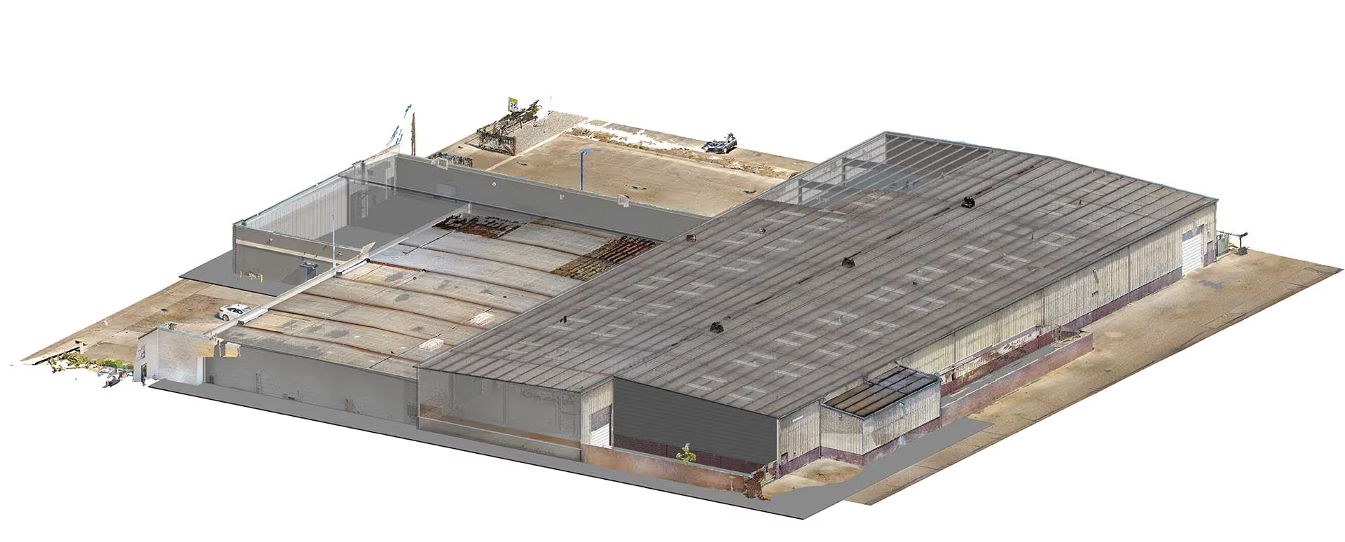
They are derived from point cloud data with millimeter-grade accuracy. Far more reliable than conventional measurement workflows.
Most commercial projects are completed within days, not weeks depending on building size and model detail.
Yes. We offer full Scan-To-BIM services at any LOD (200–400).
Yes. We service all California cities Fresno, Clovis, Bay Area, Los Angeles, Sacramento, and more.
Yes. We work on projects across multiple states. Plansrow has operational hubs in multiple regions, allowing our team to mobilize quickly. If your project is awarded to us, we can be set up and fully deployed on-site within two business days, anywhere in the U.S.


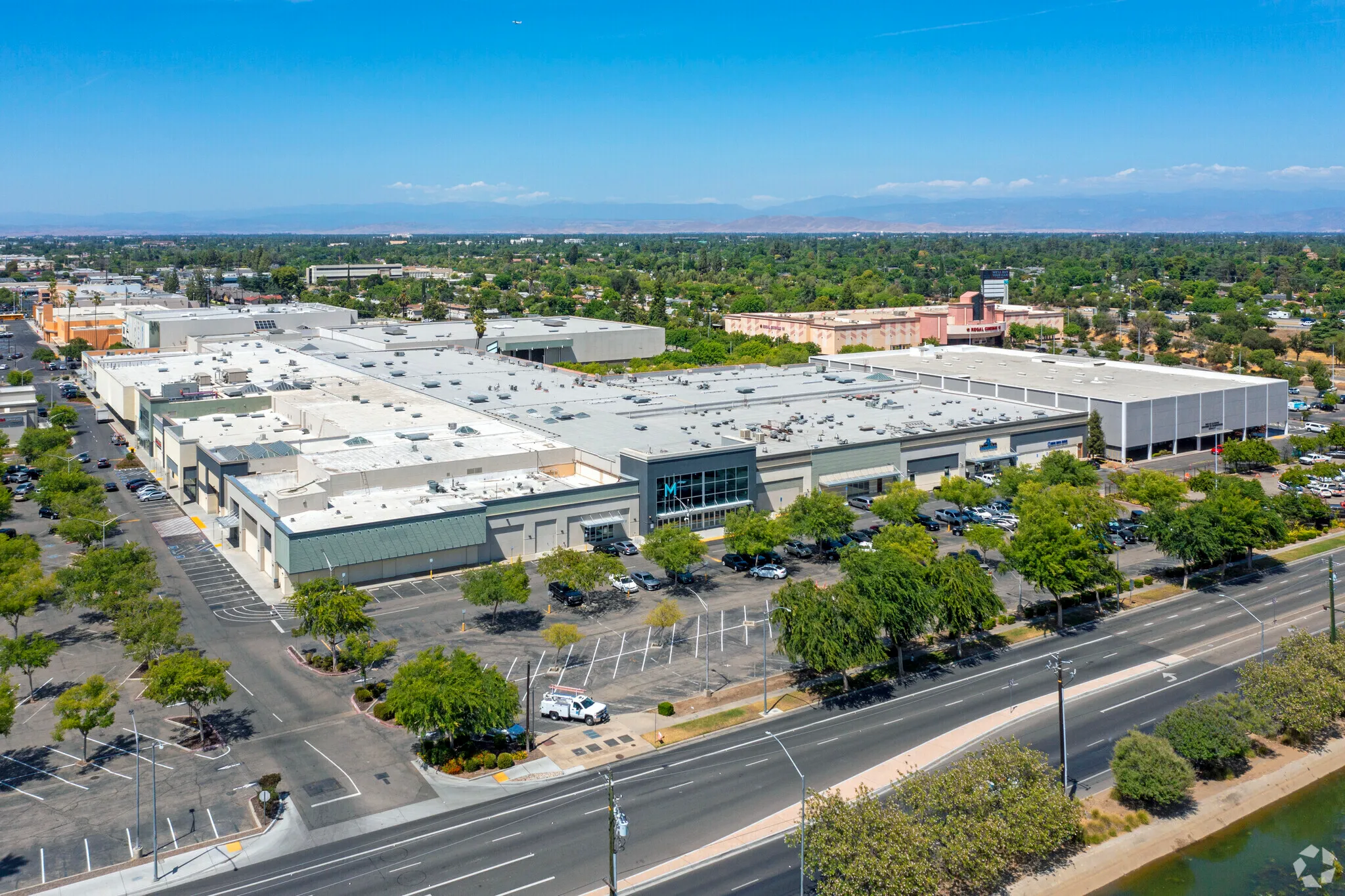
Accurate drawings that match real-world conditions not outdated plans.
Renovations, additions, and engineering projects fail when the base drawings are wrong. Plans that don’t match the field cause RFIs, rework, delays, and costly change orders.
Our As-Built Drawing Services give you precise, verified documentation built from high-resolution 3D laser scans not tape measurements or old PDFs.
You get a reliable foundation for design, coordination, permitting, and construction.

Most buildings have outdated, incomplete, or missing drawings. Our laser-based as-builts eliminate guesswork.

Every inch matters: structural walls, MEP runs, low ceilings, offsets, slopes we capture it all.

Accurate background drawings reduce RFIs, change orders, clashes, and missed conditions.

A clear, verified set of as-builts supports ongoing projects, maintenance, and facility management.
We tailor deliverables to your project type, software, and level of detail.
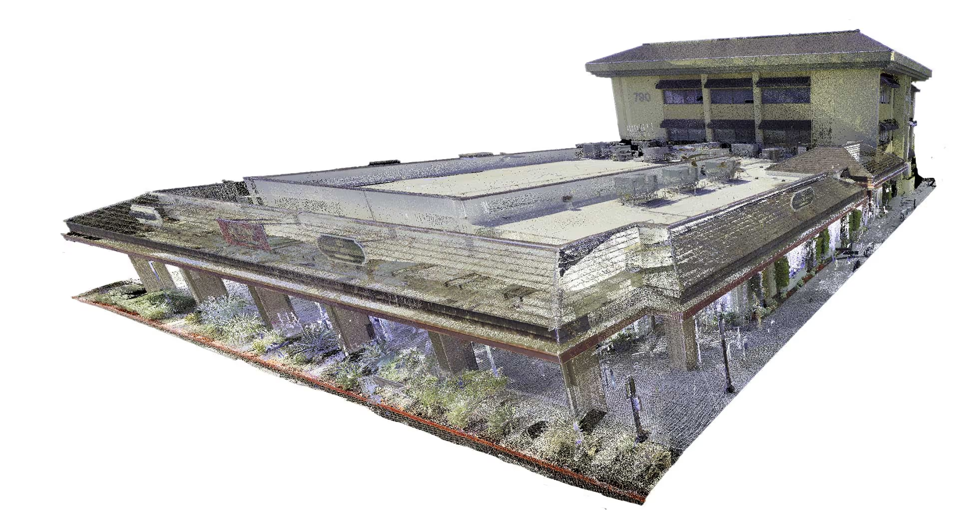
Everything is built directly from point clouds to ensure accuracy, consistency, and linework that designers can trust.
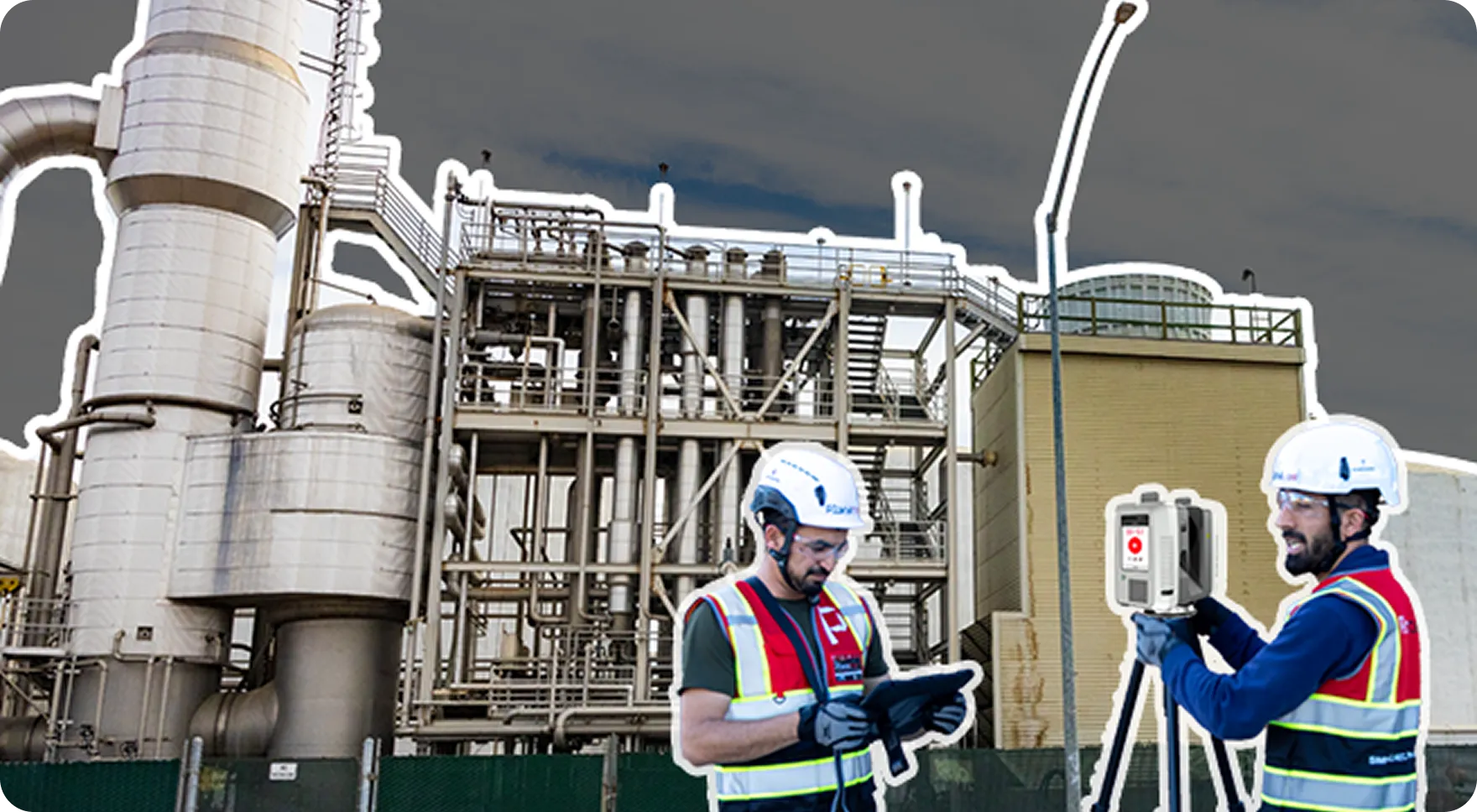
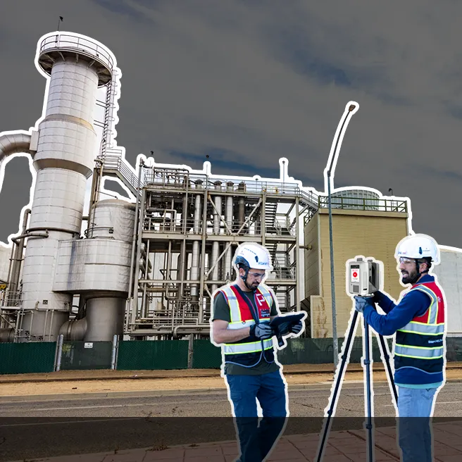
Using survey-grade 3D laser scanners, we capture millions of precise measurements from every angle. Each scan location is carefully placed to document all rooms, corridors, structures, and hard to reach areas.
You receive DWG, PDF, and Revit (if needed) ready for design, permitting, and construction.

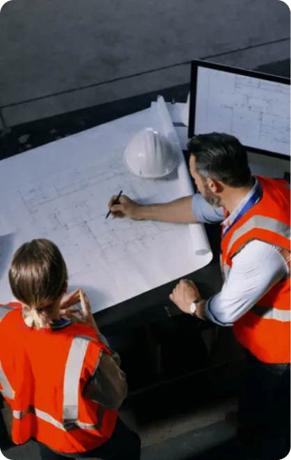
We walk the site, confirm access, and plan the scan path to ensure full coverage. This prevents blind spots and guarantees accurate existing conditions from the start.
All scan data is aligned, cleaned, and registered into a single unified point cloud. From this, our modeling team builds accurate CAD drawings or BIM models depending on your project needs. data mapping

Our expert team uses industry-leading equipment to conduct comprehensive scanning, ensuring every detail is captured.
We transform raw data into usable formats like BIM, CAD, or other digital twins, tailored to your project requirements.
You receive detailed models and visualizations, with ongoing support to integrate them seamlessly into your project workflows.

.webp)
Architects
Start design with a verified foundation, reduce surprises, and eliminate rework.

Structural, Civil, and MEP engineers
Dependable backgrounds that show real beams, utilities, mechanical rooms, slopes, and constraints.

Owners and Developers
Get a digital record for future renovations, tenant improvements, or expansions.
.webp)
Contractors
Use accurate drawings for layout, demolition plans, takeoffs, and coordination.
Your drawings reflect exact, current, real-world conditions not assumptions.


If you have a building that needs accurate existing conditions, we can help you scope a scanning plan in a short call.
Upload a plan set or a few photos and tell us what you need.
- We review your project and send a clear quote
- You approve the scope and schedule the scan
- You receive accurate digital documentation that your team can rely on
By subscribing, you agree to our Privacy Policy and consent to receive updates from our company.


.webp)
.svg)